MICASENSE SERIES
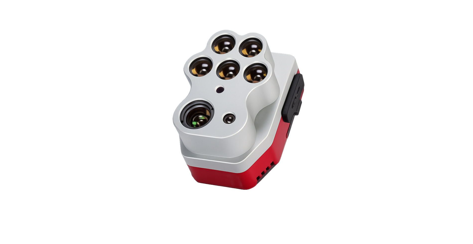
Altum-PT
Advanced Multispectral & Thermal Imaging for Precision Agriculture
The MicaSense Altum-PT delivers a powerful all-in-one remote sensing solution designed for precision agriculture, aerial mapping, and advanced crop analysis.
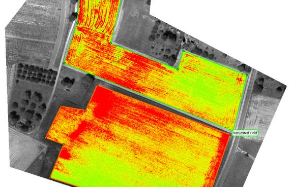
Combining a high-resolution 12 MP panchromatic sensor, integrated thermal imaging, and five discrete multispectral bands, the Altum-PT provides highly detailed aerial data for plant health monitoring, crop stress detection, and machine-learning applications such as early-stage crop counting.
Built for demanding aerial operations, the Altum-PT features a global shutter for distortion-free imagery, high-speed image capture up to 2 captures per second, and open API compatibility for seamless integration into advanced workflows.
Ideal for growers, researchers, and aerial mapping professionals seeking accurate, data-driven insights across large agricultural operations.
FEATURES
High Resolution Imaging
Pan-sharpened multispectral imagery for advanced crop analysis.
Integrated Thermal Imaging
Capture accurate thermal data for irrigation and crop stress monitoring.
Five Spectral Bands
Supports NDVI, NDRE, CIR, and advanced vegetation analysis workflows.
NDAA Compliant
Available for enterprise and government integration workflows.
Accurate results at leaf-level
resolutions.